
It was 9am and I was, much like the white rabbit, running late. I was caught up having a WWE style wrestling showdown with some waist high tussock. It’d just about pinned me to the ground, and I was on the third count when… I heard a whistle. I broke free from the tussle and looked upwards at the scree slope ahead of me.
There, silhouetted against a bright blue sky and every so slightly obscured by whisps of encroaching cloud, were the outline of two human beans. “Hi Kevin!!!” I shouted at the top of My lungs. “…I’ll, err, be there in a minute…” Which seemed like an obvious continuation, but something I should mention, just to be polite.

The Scree slope where Kevin and Sid appeared
In fact, I lied – It was a good four minutes before I’d scrambled my way to the top. Between gasps for air and an effort to relocate my lost lungs, I reached out a hand. “Hi (gasp) I’m (gasp) Anna.”
I’d never met Kevin before. But he was a friend of a friend (of a friend) and had emailed last week to offer me a ride around a rather big scary river. We’d arranged to meet at Crooked Spur hut, just at the edge of the Two Thumbs range. Unfortunately in my 3 day journey to the hut I’d been slowed up by a) thick fog b) chatting c) more chatting, and so I was a day overdue in my arrival. With no way of communicating with one another I decided to leave as early as possible the following morning to make the rendezvous point. I wasn’t too worried. Kev seemed like just the most laid back bloke in the Southern Hemisphere, and I figured he’d know I’d appear sooner or later.
Introductions made, along with a loose plan of action for the day I bounded down to the Crooked Spur hut, with Kev and Sid following close behind. There we had ourselves a spot of luncheon. I was running a bit low on food and all I had left were a few crackers and some wine gums, so I gleefully munched on the apples, apricots, scroggin and oysters from a can (?!???!) that the lads had brought with them.
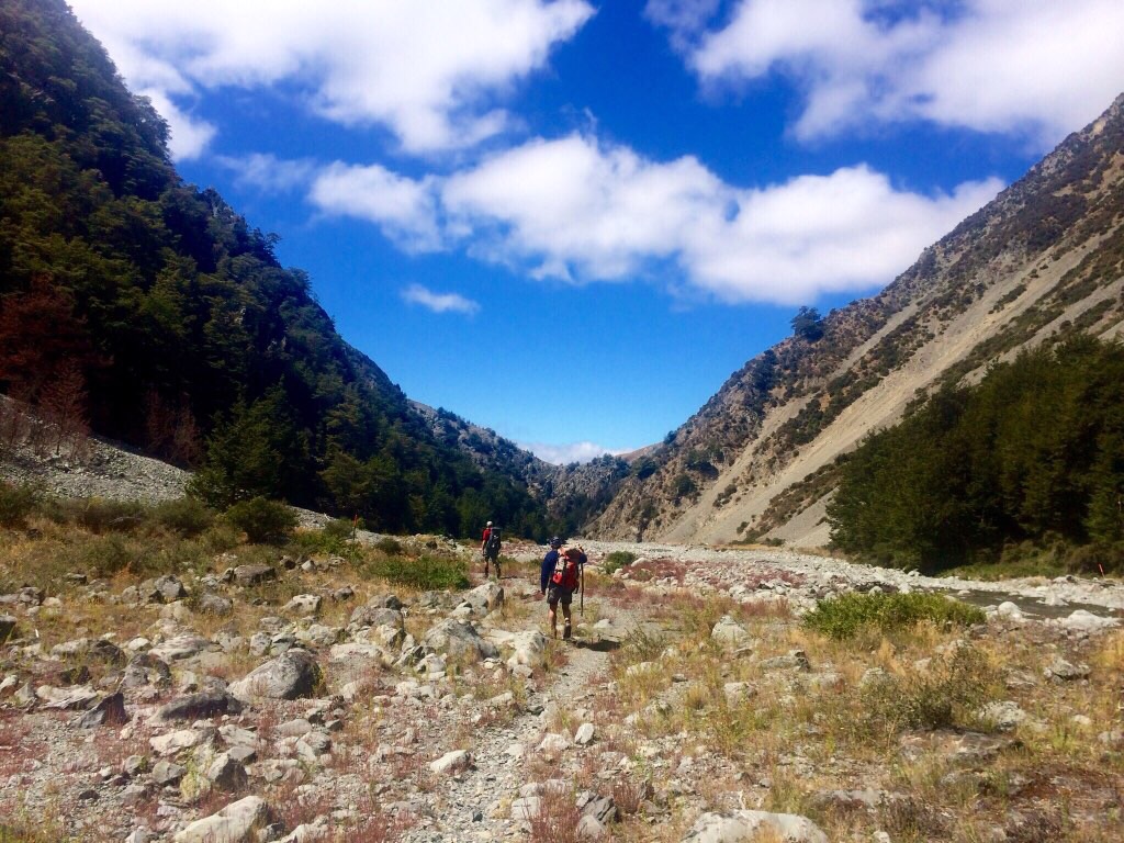
Chasing the backcountry dudes down the valley toward the Rangitata.
As it turns out, both of them were rather accomplished outdoorsmen. Syd casually regaled the time he’d had climbed Denali / Mt McKinley and it became quickly apparent that he was somewhat of a backcountry dude. Kevin was simlarly dude esc, although admitted he wasn’t quite in Syd’s keague when it came to alpine climbing. “What’s the most memorable climb you’ve done?” I asked Sid. Turns out it was a night he’d spent stranded on the Mount Cook Grand Traverse – an icy ridgeline that connects the low, middle and high peaks of the mountain. Sid told me that one of the group had broken a crampon and so the going was slower than they’d expected. They’d had to spend a night of the ridge and continue the traverse at first light. “Yeah I guess it was pretty hard to sleep, with a sheer drop to either side, but I slept a bit. At least I brought my sleeping bag with me, just in case. The others had nothing.” CRIKEY.
TWO RIVERS (AND A RANT)
There are two big rivers in the South Island. Well, there are more than that, but there were only two I needed
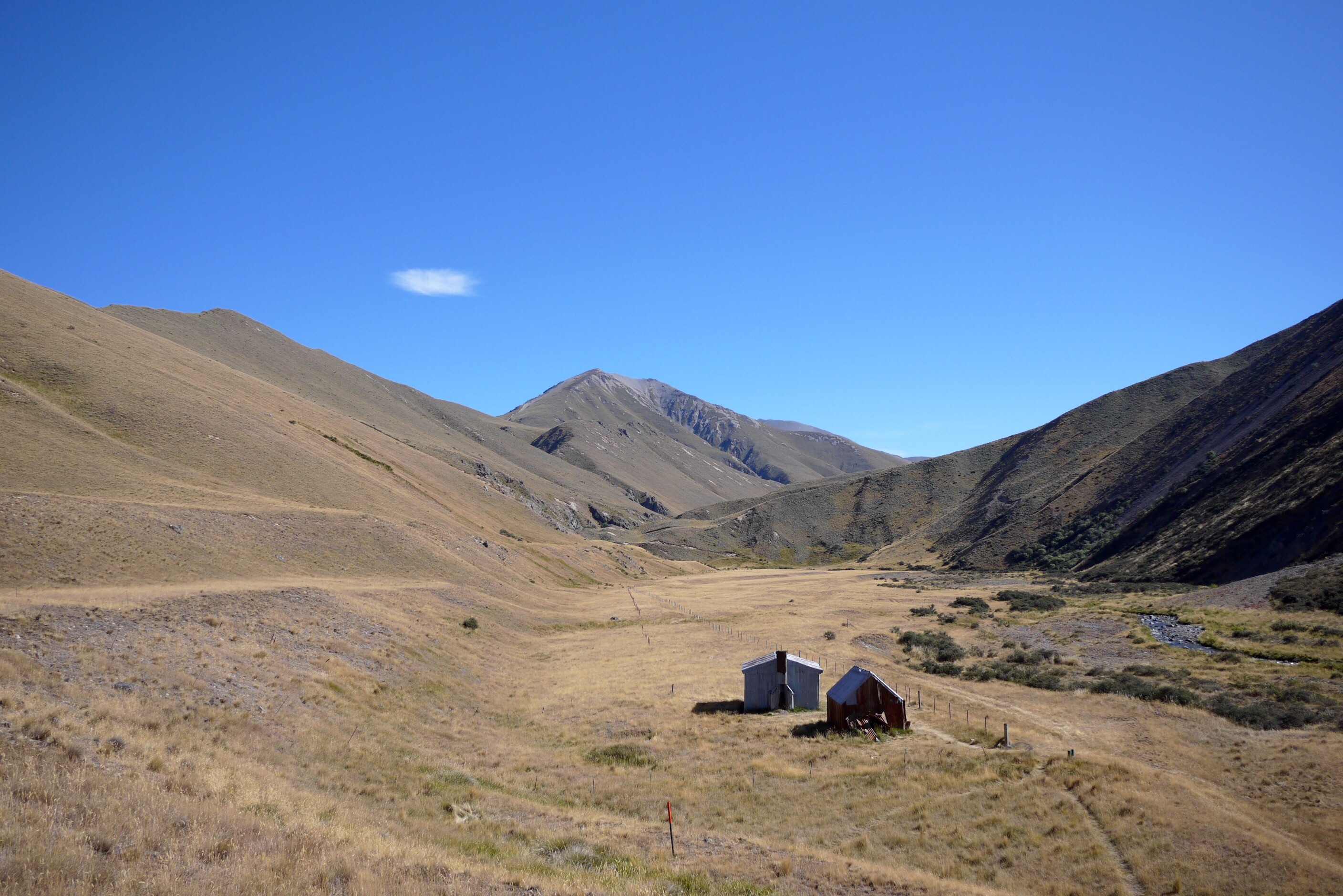
Between the big rivers – Comyns old sheep muster hut
to be really concerned with. Rather unhelpfully, they both begin with the same letter. And so when referring to either the Rangitata (big river) or the Rakaia (even bigger river) I often get them mixed up. I’ll assert that I wasn’t alone in this, and many other trail users also did the same. Sometimes I even go for a hybrid river name: the Rakigitata (sounds like an Indian side dish) or the Rangania (sounds like an STI). The fact is there are so many places, obstacles, logistical things to be dealing with that my brain can only really function a week or two ahead. Which is why when Southbounders (SOBOs) begin helpfully telling me about places in the North island – I see their lips moving, but all I hear is lift music.
Anyway, I digress. These rivers. They are big and braided and knarley. And when I say braided I mean that they sprawl into a multitude of channels, of different depths and speeds, so really what you’re crossing are 7 rivers. The Rangitata, for example, if you do decide to cross it will take you around 1.5 hours to get to the other side. And sometimes you might get half way and realise that you can’t continue on, leaving no choice but to turn back.
The Rakaia is a different beast entirely, and the trail notes say under no circumstances should you attempt to cross the it. So when I hear tales of Te Araroa trampers who’ve crossed it, I’m quite sure what to think (I’ll pause briefly here and hold up my rant card). I understand the trampers frustration – they’re tired, they want to push on and it can take a full extra day, sometimes two, to hitch rides around the river. Passing traffic on the roads is slim to none. But my thinking is – what’s two days as a price to pay for your life? I’d say it’s a fair trade.

Looking down towards the big beasts Rakaia
Of course everyone is responsible for themselves at the end of the day, and if they feel that they’re equipped with the skills to cross the Raikia – then OK. What’s definitely not okay (and what really got my running pants in a twist) is when those headed South write in the hut books where they’ve crossed, and encourage others to do the same. 150 people are travelling along the Te Araroa this year, including some as young as 19 on their first big trip. I worry that unless something is done to help trampers get safe and easy passage around the Rakaia, there’ll be a sad tale to tell in years to come. I have a friend who’s friend was swept away on the river. So yes, going around it may be a pain in the arse. Or perhaps it’s just an additional mini-adventure? I’ll view it as the latter.
It didn’t take me too much thought to decide that crossing either of these rivers wasn’t something I needed to ‘do’. So I enjoyed a nice 80km run round the Rakaia to the nearest bridge (with a bonus sleep in a bush on the way) and for the Rangitata – I let Kev give me a ride out on one side. And after a break in Christchurch I got a ride back to the trail on the other side. Magic.
[wpvideo rs2uxabK]
A rather happy me on the way down to the Rakaia.
CHRISTCHURCH
Four years on and the wounds of a city ravaged by multiple earthquakes are still open for all to see. I wasn’t sure how I’d find Christchurch, but I consider my trip there to be a true blessing. To get a first hand look at the lives of individuals being rebuilt from the rubble is possibly one of the most humbling experiences I’ve had.
When the September 2010 quake hit it was 4am. From those I spoke to, most reported that they didn’t even make it out of bed. They’d just turned to their loved one, held them tight and waited for the end. To hear someone describe that scene put a significant lump in my throat. I cannot begin to imagine what that feels like, even considering it made me want to call all of my loved ones then and there.
The more devastating February 2011 quake created the biggest peak ground acceleration recorded anywhere in history – a vertical movement with a force of up to 2.2 times gravity. It was this acceleration and the close vicinity to the city that led to 185 people loosing their lives, over 100,000 homes damaged and 10,000 completely destroyed.
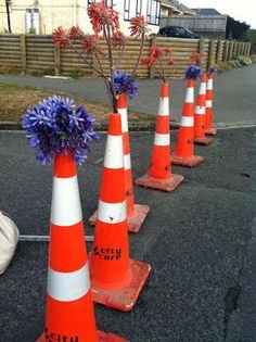
A Christchurch tribute: agapanthus in traffic cones line the streets each year
Everyone in Christchurch has a story to tell, because everyone was somewhere when the quakes happened. One woman was two minutes away from arriving in a shop, where everyone inside was killed. Another man wasn’t sat in his chair by the window as usual that day, a window that broke into large jagged shards and spread across the living room. I heard the tale of another young lady who’d run miles across town, as far and as fast as she could to escape the central business district.
But from great tradgey, hope springs eternal. And the tales from Christchurch are no different. Art, music, funky pop-up malls are all around. I visited the ‘cardboard cathedral’, made in part quite literally out of cardboard (albeit reinforced in many places) – erected as a temporary replacement for the city’s original gothic stone building.
Each year on the anniversary of the quake, residents place a traffic cone outside in the street, with an agapanthus in the top. These cones aren’t just a memorial to those who lost their lives, they’re a nod to the future too. A reminder that amongst them live a community of people with the strength and spirit to prosper, when all the physical elements of their world have fallen into disrepair.
Well, it’s time to slip my trainers on again and go and play with some mountains. Next week I’ll tell you all about backcountry huts (aka the shacks) and that day I went ahead and cried my eyes out.
Until then, please except a gigantic high-five and have yourselves a splendid week.
Much running-love,
McNuff xx
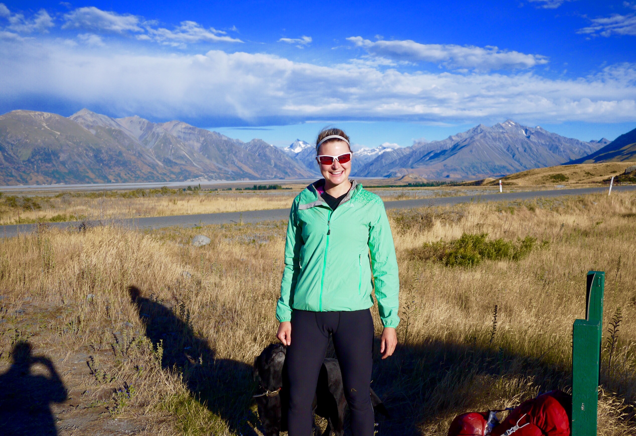
Setting off from the North side of the Rangitata river
